
Geodaten Deutschland 18.10
|
Geodaten Deutschland screenshot 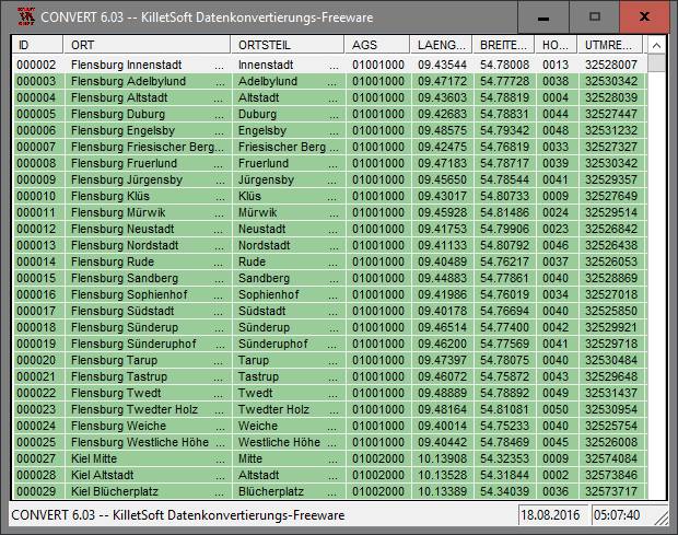 |
The database tables contains geodata of the Federal Republic of Germany with geo referenced towns, municipalities, town quarters and other administrative units, postal codes, telephone preselections, nature areas, landscapes, climatic zones and official topographical cartographies. The data contain coordinates for navigation and geo-coding, proximity searches and distance computations and are prepered for the spatial mapping of environmental information. Quite often it is necessary to reference an address field e.g. like town or municipality name, postal code or telephone preselection, to corresponding geographical data and coordinates - a Geo Reference. The geo reference can be used e.g. to direct a customer to the closest store locations of a retail store chain by doing a proximity search. Another possibility it to determine distances between the different objects of the database tables with the included geo references. With the elevation data from a Digital Elevation Model the ground level height of each place can be determined. Often the knowledge is necessary about affiliations and relationships between data derived from different hierarchies. So it can be determined to which federal state, governmental area or governmental county a town, a postal code or a telephone preselection is associated. It is possible to assign a variety of natural and scenic information to each town or municipality. The snow and wind load zones and solar irradiation are available as local climatic data. In conjunction with the ground level heights they can be used to calculate static loads for the planning of building constuctions and to calculate solar installations. Databases: 11.500 Towns and Municipalities, 108.000 Town Quarters, 31.000 Postal Codes, 19.500 Telephone Preselections, all with geo references, 400 Administrative Countys, Administrative Districts, Federal States of Germany, Landscapes, Nature Area Classification, Snow and Wind Load Zones, Solardata, Cartographies.
Program Details
| Released: | 2014-10-30 |
| More: | All programs by this author |
| Downloads: | 195 |
| License Type: | Data Only |
| Platform: | WinXP,WinVista,WinVista x64,Win7 x32,Win7 x64,Win2000,WinOther,Mac OS X,Windows2000,Windows2003,WinServer,Windows Vista Ultimate,Windows Vista Ultimate x64,WinMobile,Windows CE,Android,BlackBerry,Palm |
| Homepage: | http://www.killetsoft.de/p_dgda_d.htm |
| Price: | $205.00 US |
Related Listings
|
|
Clix-FX XML Flash Menus Clix-FX Flash XML Menu Templates the easiest way imaginable to create web menus |
|
|
Geoitem Support of the directory of basic geodetic points |
|
|
Web2Map Internet Recherche Manager with offlinereader, fulltextsearch, archiving,... |
|
|
Sticker Book 6: Superheroes Create action scenes using superhero stickers. |
|
|
SceneSaver Display your own or the beatiful included images as wallpaper or screen saver. |
|
|
Acc Compact Utility for Microsoft Access database developers and administrators. |
|
|
C-Photo Recovery Recover deleted pictures and restore corrupted photographs with C-photo Recovery |
|
|
ImageGrabDummy! Download and view mass images from the web by keyword or url. |
|
|
DataTron DataTron is an easy-to-use visual data base |
|
|
DisCatalog v3 Catalog disks with preview: CD, DVD, MP3, Photos, digital cards. |
|
|
Recover External Hard Drive Files USB digital media data retrieval application rescue deleted files and folders |
|
|
Golf Handicapper Stores golf scores for multiple players.Calculates handicap, index, net score |
|
|
Database Assistant Manipulate data from a variety of databases including Oracle, SQL Server, et al |
|
|
Link Web Extractor Extracts from Search Engines or a list of URLs, E-mails, Phones, Fax and more... |
|
|
DataPoint for Microsoft PowerPoint 2013 PowerPoint add-on to automatically update slide content |