
GeoDLL 15.19
|
GeoDLL screenshot 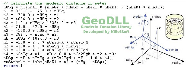 |
GeoDLL supports the development of geodetic software on various platforms by providing geodetic functions. GeoDLL contains precise calculations on the themes 2D and 3D coordinate transformation, geodetic datum shift and reference system converting, meridian strip changing, user defined coordinate and reference systems, distance calculations, Digital Elevation Model, NTv2 handling and BeTA2007 support, Direct / Inverse solutions, map function and geodetic converting functions. The most important application of GeoDLL is to include professional coordinate transformations in own programs. These coordinate and reference systems are supported: 1. The current and many historical coordinate and reference systems of all countries of the European Union (EU) including the eastern extensions and the systems of the European non-EU countries. 2. The European ETRS89 systems forced by INSPIRE with respect to the continental drift. 3 .The US and Canadian State Plane Coordinate Systems (SPCS) and other systems of the North American continent. 4. Many coordinate and reference systems of the countries of all continents and the world-wide used coordinate and reference systems. 5. World-wide NTv2 grid file supported coordinate transformations. 6. The coordinate and reference systems of the old and new German Federal States, the 40 Prussian Soldner Land Registers, the German 'Lagestatus', special reference systems of the German Federal States and BeTA2007. 7. User defined coordinate systems, reference systems and earth ellipsoids. GeoDLL comes with extensive documentation and is supplied as DLL file or as C++ source code for 32bit and 64bit architectures. The DLL works with most programming languages and it can be used with Microsoft Office programs. The DLL is written in C++ and was developed with Microsoft Visual Studio 2010. Thus very fast performance, compact code and high stability are assured. The functions of GeoDLL are prepared for multithreading.
Program Details
| Released: | 2015-08-27 |
| More: | All programs by this author |
| Downloads: | 404 |
| License Type: | Shareware |
| Platform: | WinXP,WinVista,WinVista x64,Win7 x32,Win7 x64,Win2000,WinOther,Mac OS X,Windows2000,Windows2003,WinServer,Windows Vista Ultimate,Windows Vista Ultimate x64,WinMobile,Windows CE,Android,BlackBerry,iPho |
| Homepage: | http://www.killetsoft.de/p_gdla_e.htm |
| Price: | $690.00 US |
Related Listings
|
|
United States Geography Tutor Master U.S. geography! Includes study mode and two test modes. |
|
|
Text2Html Text2Html is a freeware plain text to HTML converter |
|
|
TempLAB TempLAB is not a real lab, but definitely a handy temperature conversion tool. |
|
|
Geoitem Support of the directory of basic geodetic points |
|
|
Pdf2Txt PDF TO TEXT Converter, supports batch conversion and command line |
|
|
SimpleOCR Free OCR to convert scans to text & word; Royalty-free character recognition SDK |
|
|
DoneEx AppBinder DLL This DLL allows you to redirect DOS or Win32 console standard streams data |
|
|
DoneEx AppBinder ActiveX Redirect DOS or Win32 console standard streams from your Windows application |
|
|
SOCKShell Adds pre-defined and your own options to the Windows Explorer context menu. |
|
|
PhotoKit-EL PhotoKit-EL gives you all the wonders of a darkroom without the chemicals. |
|
|
DoneEx INI-File Manager ActiveX This ActiveX allows you manipulate with INI-file from any programming language. |
|
|
Split PDF COM Component Split PDF software automates the process of splitting multiple PDF files |
|
|
Moffsoft Calculator Calculator with tape, financial functions, unit conversions, and much more |
|
|
Able2Extract View and convert PDF data to Word, Excel, PowerPoint and Publisher |
|
|
Blocker Plains Reaction game with a freely moveable blocker, 50 stone plains and much sound. |