
Geodata International 7.01
|
Geodata International screenshot 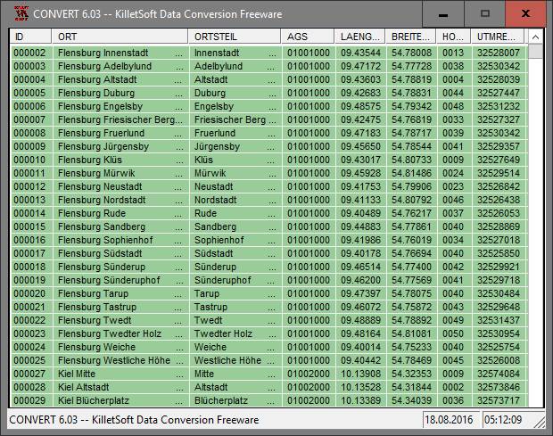 |
Geodata International - World-wide database of countries with georeferenced towns, municipalities, postal codes and administrative units with WGS84 and UTM coordinates and elevations for geocoding, proximity search, navigation, distance calculation. Often is it necessarily, for an address characteristic, e.g. the place name or the postal code, to establish a local relationship - a georeference. The georeference can be used e.g. to show a customer the nearest chain store by doing a proximity search. On the basis of the georeferences business zones, statistics or general maps can be made. Towns, municipalities and postal codes can be assigned to the superordinated administrative units. Distances between places or postal areas can be determined with the coordinates contained in the database tables. For that the georeferences are available in all country database tables as UTM coordinates on the natural and an uniformly meridian strip and as geographical coordinates in degree and deg/min/sec notation. With the elevation data from a Digital Elevation Model the ground level height of each place can be determined. The database tables are present in the file format CSV (Comma Separated Values). The character set used is UTF8. This format is used often and in most cases you can import data directly into your own data system. The freeware program CONVERT, downloadable from the KilletSoft site, converts the available database tables to other data formats and character sets with the necessary sortings and selections. With the program, for example, CSV data can be converted to the SDF format (Simple Document Format) or to the dBase format. For the use of the data on different platforms it is possible to select between the character sets ASCII, ANSI, UTF8 and UniCode. Thus the import of the data in any database management system or file system will be possible.
Program Details
| Released: | 2015-02-26 |
| More: | All programs by this author |
| Downloads: | 413 |
| License Type: | Data Only |
| Platform: | WinXP,WinVista,WinVista x64,Win7 x32,Win7 x64,Win2000,WinOther,Mac OS X,Windows2000,Windows2003,WinServer,Windows Vista Ultimate,Windows Vista Ultimate x64,WinMobile,Windows CE,Android,BlackBerry,Win9 |
| Homepage: | http://www.killetsoft.de/p_igda_e.htm |
| Price: | $600.00 US |
Related Listings
|
|
Clix-FX XML Flash Menus Clix-FX Flash XML Menu Templates the easiest way imaginable to create web menus |
|
|
Cresotech PhotoPoint Multimedia tool to create a photo presentation just in seconds. |
|
|
Geoitem Support of the directory of basic geodetic points |
|
|
Sticker Book 6: Superheroes Create action scenes using superhero stickers. |
|
|
Acc Compact Utility for Microsoft Access database developers and administrators. |
|
|
C-Photo Recovery Recover deleted pictures and restore corrupted photographs with C-photo Recovery |
|
|
DataTron DataTron is an easy-to-use visual data base |
|
|
Recover External Hard Drive Files USB digital media data retrieval application rescue deleted files and folders |
|
|
Golf Handicapper Stores golf scores for multiple players.Calculates handicap, index, net score |
|
|
Database Assistant Manipulate data from a variety of databases including Oracle, SQL Server, et al |
|
|
Grammar Slammer with Checkers Easy, complete English grammar + spelling help with grammar + spelling checkers. |
|
|
Link Web Extractor Extracts from Search Engines or a list of URLs, E-mails, Phones, Fax and more... |
|
|
DataPoint for Microsoft PowerPoint 2013 PowerPoint add-on to automatically update slide content |
|
|
csASPUpload Upload files using a browser and ASP. Multiple files. Can export binary data. |
|
|
CMS CRM (5 User) CMS Customer Relationship Management System |